← Browse Dives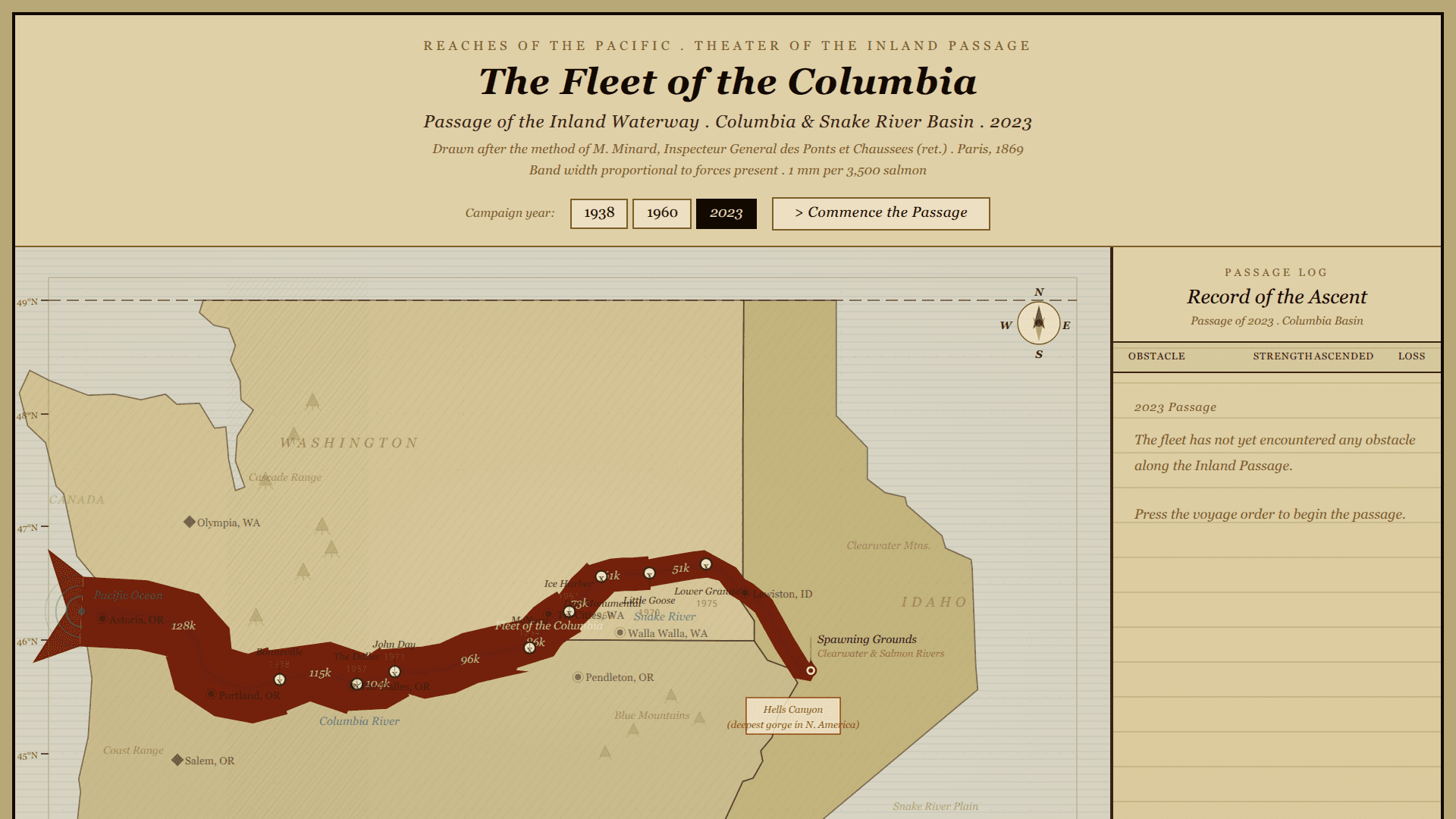
Loading Interactive Dive...
The Salmon Run — Columbia Basin Migration Atlas
A Minard-style flow map of Chinook salmon migration through the Columbia and Snake River basin. Styled as a 19th-century military campaign map, the Fleet of the Columbia traces its passage from the Pacific Ocean through eight dam fortifications to the spawning grounds. Animated with a passage log recording each encounter, fish population data for 1938, 1960, and 2023.
MapScience
Author: Mehrab Rahman · June 5, 2026 Region: us-east-1
AI Prompts Used
1Prompt 1
Create a Minard-style flow map of Chinook salmon migration through the Columbia and Snake River Basin as a MotherDuck Dive. Style it as a 19th-century military campaign map — parchment background, engraved serif fonts, crosshatch terrain, mountain symbols, double-ruled rivers. The band width represents fish population, narrowing at each of the 8 major dams to show mortality. Show three years: 1938, 1960, and 2023. Animate the salmon's journey from the Pacific to the spawning grounds, pausing at each dam. Include a sidebar log that fills in as each dam is encountered, recording the date, fish count, and losses. Call it The Fleet of the Columbia.
2Prompt 2
Make the animation smooth and fluid, the band geometrically accurate to Minard's style with sharp instantaneous width changes at each dam rather than gradual tapers, and the overall aesthetic as close to a genuine 19th-century engraved campaign map as possible. Give the salmon band a fish tail at the start and a wedge head at the front. Add period typography, a compass rose, tide-mark arcs at the ocean entry, geographic labels, and a field journal styled sidebar that records each dam encounter with arrival dates and casualties.
Comments
Log in to leave a comment.
No comments yet. Be the first!